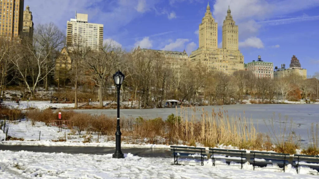


Travelers hoping for snow-covered streets in New York City or Boston will have a clearer picture as Christmas approaches. AccuWeather meteorologist Paul Pastelok told Travel + Leisure that he expects few cities along the East Coast’s Interstate 95 corridor to have snow on the ground for the holiday. His comments were published Nov. 18.
Pastelok sees better prospects farther north, particularly in interior Maine. NOAA’s Nov. 19 outlook favors a warmer-than-normal December in parts of the Northeast. Local forecasts closer to Dec. 25 will give travelers a better idea of whether snow could fall or remain on the ground at their destination.
Snow on the ground is what counts
The National Weather Service defines a white Christmas as at least 1 inch of snow on the ground at 7 a.m. local time on Dec. 25. Snow left by an earlier storm counts if enough remains that morning. Fresh snow that accumulates later in the day comes after the measurement.
Advertisement
Advertisement
NOAA’s historical map uses the 1991–2020 climate normals to show where Christmas morning snow cover has been more common. It gives travelers a way to compare destinations before local holiday forecasts are available.
A cold stretch can help snow from an earlier storm last until Christmas morning. Rain or milder temperatures can reduce the snowpack. Travelers hoping to see a snowy landscape can check the current snow depth and the forecast for new snow.
New York and Philadelphia rarely meet the mark
New York City’s Central Park had a 13.2% historical chance of at least an inch of Christmas Day snow cover, according to a Men’s Journal analysis of NOAA’s 1991–2020 data. Philadelphia’s historical figure was 9.3%. Those numbers describe conditions at the stations used in the analysis and give a baseline for the two cities.
The Boston comparison is less direct. The city’s main weather station was excluded from that analysis because it does not measure snow depth. Pastelok put the broad historical range from northern Florida to Boston at 0% to 25%, a regional estimate rather than a percentage for downtown Boston.
Advertisement
Advertisement
Elevation and distance from the coast can change the picture over a short drive. A hillside station outside a city can hold snow longer than a site near the waterfront. For a city trip, the most relevant reading comes from a station close to where travelers plan to stay.
NOAA favors a mild December in parts of the Northeast
NOAA’s Climate Prediction Center said the probability of above-normal December temperatures exceeds 50% in parts of the Northeast. Forecasters identified a very strong El Niño in the tropical Pacific as a major influence. The pattern can shift storm tracks and affect which regions are more likely to be warm, wet, or dry.
The same outlook favors above-normal precipitation along parts of the Atlantic coast into southern New England. That category covers all forms of precipitation. A wetter December can bring more rain, and even a storm that starts with snow can change over if warmer air moves in.
AccuWeather’s separate winter outlook calls for substantially less snow than last winter in Boston, New York, and Philadelphia. Its outlook covers the season, so a well-timed storm could still leave snow in one of those cities before Christmas. AccuWeather also says significant storms remain possible in places where it expects lower seasonal snowfall overall.
Coastal storms need cold air at the right time
Pastelok told Travel + Leisure that Atlantic waters are generally still warm enough in December to make coastal snow harder to come by. When a storm draws in milder air from the ocean, communities near the water can see rain or a mix of precipitation. Inland areas can be cold enough for snow during the same storm.
Advertisement
Advertisement
The storm’s path also matters. A shift in the track can change where cold air is trapped and where warmer air reaches the ground. That can put a rain-snow boundary between places that are only a short distance apart.
Timing is just as important as the path for a white Christmas. Snow arriving earlier in the week needs to last through Christmas morning. A storm that arrives afterward could still affect the trip home, even though it would come too late to count toward the holiday’s snow-depth measurement.
Inland Maine has a stronger track record
The National Weather Service in Caribou says Bangor has recorded at least 1 inch of snow on the ground on about 73% of Christmas mornings in its long-running records. Farther north, Caribou has met the threshold about 93% of the time. The local office uses longer records than NOAA’s 1991–2020 national map, so its percentages reflect a different period.
Pastelok said interior Maine generally has better prospects than communities along the coast. Travelers looking at Portland or Bar Harbor can use a local forecast for those destinations. Conditions farther inland or north can be quite different, even when the same storm moves through Maine.
Advertisement
Advertisement
Last year showed how much one storm can change the holiday landscape. The National Weather Service reported that a Dec. 23–24 storm dropped roughly 6 to 9 inches in parts of southern Piscataquis, western Penobscot and western Hancock counties. That snowfall arrived just ahead of the holiday in those areas.
Travelers can check snow depth before leaving
Travelers who want to stay in the East can start with inland northern New England or upstate New York, both of which stand out on NOAA’s historical map. If the trip is mainly about seeing snow, a flexible reservation leaves room to choose between destinations once local conditions are clearer.
About a week before departure, check the National Weather Service forecast for the specific town or ZIP code. Look at daytime temperatures, any rain in the forecast, and current snow depth as well as expected snowfall. At a ski destination, a resort’s trail report can help show which slopes are open, while local snow-depth observations give a better sense of what nearby towns look like.
Drivers can also check state road conditions before heading inland or into higher terrain. The same storm that makes a destination look more like Christmas can reduce visibility or slow the drive. Checking the route and destination together can help travelers choose when to leave.
TL;DR
AccuWeather meteorologist Paul Pastelok expects few cities along the East Coast’s I-95 corridor to have snow on the ground for Christmas.
From 1991 to 2020, the historical odds of Christmas morning snow cover were 13.2% at New York City’s Central Park and 9.3% at Philadelphia International Airport.
NOAA’s November outlook favors a warmer-than-normal December in parts of the Northeast.
Pastelok sees better prospects for Christmas snow cover in interior Maine.
A white Christmas means at least 1 inch of snow on the ground on Christmas morning. Snow from an earlier storm counts if enough remains.
This article was made with AI assistance and human editing.
If you liked this, you might also like:
Advertisement
Advertisement
The post White Christmas 2026 outlook points to slim odds in New York and Boston appeared first on When In Your State.
Source link