

Key Points
The Rim of the World Scenic Byway stretches more than 100 miles through Southern California’s San Bernardino Mountains, reaching elevations above 8,400 feet.
The winding route features dramatic desert views, alpine forests, mountain lakes, and charming communities including Crestline, Lake Arrowhead, and Big Bear.
Summer and fall offer ideal driving conditions, and travelers should allow one to three days to enjoy scenic overlooks, hiking trails, and lakeside activities.
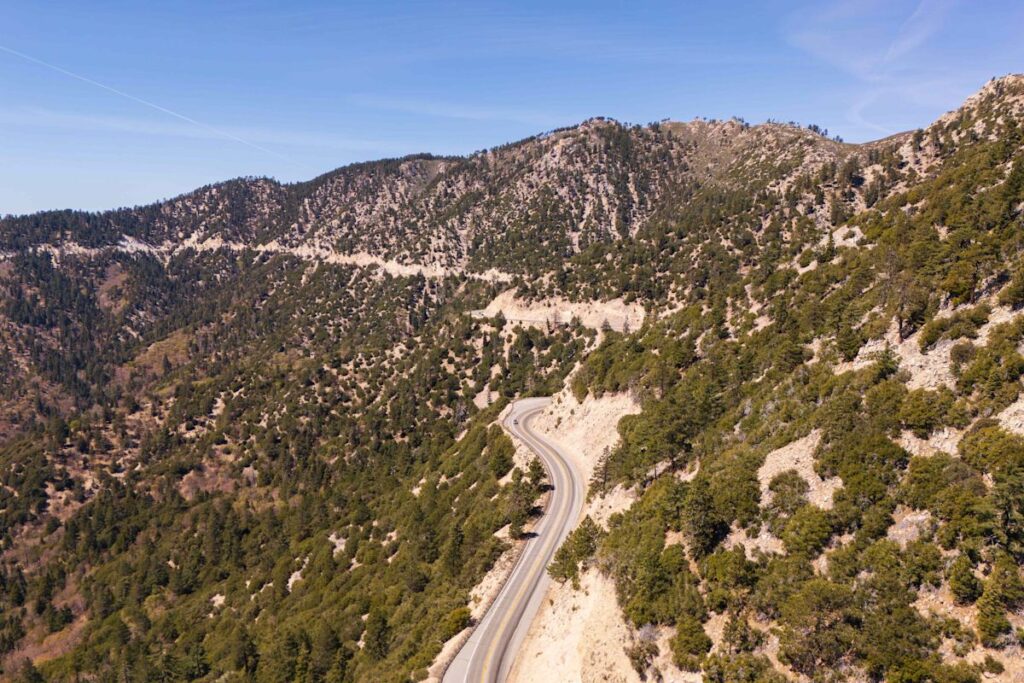
Starting from the desert floor east of Los Angeles, the Rim of the World Scenic Byway curves 110 miles eastward into the San Bernardino Mountains. Once you begin driving up (and up and up), ultimately reaching more than 7,000 feet above sea level, it becomes easy to see just how the route got its name. The Rim of the World is a particularly narrow ribbon of asphalt, packed with hairpin turns and sheer drop-offs on either side of the road.
As daunting as it may seem, though, all of that climbing leads to some of the most impressive views in Southern California. Beyond the aforementioned desert, drivers will pass through dense alpine forests and hardy chaparral ecosystems. Outside the windows, expansive panoramas of the Inland Empire stretch to the horizon. You’ll even get to see several picturesque lakes, a rarity in this dry corner of the Golden State.
Advertisement
Advertisement
The route also runs by a few of SoCal’s most charming mountain communities, like the town of Crestline, California. “The Rim of the World Scenic Byway is a reminder that sometimes the journey really is the destination,” says Raeann Idle, the office manager at the Crestline Chamber of Commerce. “Whether you’re a local looking at the mountains from a new perspective or a first-time visitor discovering the area, the drive offers a beautiful mix of scenery, fresh mountain air, and those unforgettable views that make you want to stop and take one more picture.”
While you can cover the full route in just a few short hours, you’ll want to put much more time than that into your drive.
Here’s what you need to know before planning a drive on the Rim of the World Scenic Byway.
Best Time to Drive
A woman sits with her dog on a park bench on the shore of Lake Gregory.
Credit: Try Media/iStockphoto/Getty Images
Whereas most of California’s scenic drives remain accessible all year-round, the Rim of the World Scenic Byway is much more seasonal. Ideally, you should plan to drive the route during summer or fall, since the road can get icy and snow chains may be required (yes, Southern California gets snow) during winter and early spring.
Advertisement
Advertisement
In the summer, the route and its accompanying destinations are typically much more comfortable than the surrounding, low-elevation areas, giving drivers a welcome respite from warmer parts of the region. It’s also a great time of year to cool off with a lake visit—you can stop to play at the inflatable waterpark at Lake Gregory in Crestline, or kayak and paddleboard at Big Bear Lake.
Between mid- and late October, meanwhile, vibrant fall colors line the Rim of the World Scenic Byway. Drivers can pull off to stretch their legs at hiking trails like Heart Rock and Castle Rock, which will have cooler temperatures and foliage views sure to impress even the most avid leaf-peepers out there.
Know Before You Go
Arriving to Lake Arrowhead Village on a sunny summer day.
Credit: Getty Images
As mentioned earlier, the Rim of the World Scenic Byway is a very winding drive with a good deal of steep drop-offs. So, if you suffer from car sickness and/or a fear of heights, plan ahead with motion sickness medication (and perhaps help from a second driver if necessary).
Having another driver along for the ride will also allow you to slow down and really take in the views. Driving the Rim of the World in its entirety typically takes two to three hours, but you should ideally set aside at least one to three full days so you can enjoy the sights and stops along the way.
Advertisement
Advertisement
“The Rim of the World Scenic Byway is perfect for a mini-road trip because the highway itself is part of the adventure,” says Idle. “Give yourself plenty of time, stop at designated overlooks when you can, and explore the mountain communities along the route. It’s not a drive you want to rush through; the views are a big part of what makes the experience so memorable.”
That includes the towns of Big Bear, Crestline, and Lake Arrowhead, all of which host essential amenities like gas stations, restaurants, and overnight lodging. You should plan to fuel up whenever possible—the route passes through some fairly remote parts of the San Bernardino National Forest, and you don’t want to end up stuck on the side of the road without gas or cell service.
While you’re on the byway, keep an eye out for wildlife like bears and deer, and stick to a slower pace of driving. Many of the route’s tight turns include blind corners, so while it might be tempting to speed up and “canyon carve,” it’s much safer for you, others on the road, and the wildlife if you take it slow.
Stops Along the Route
Even before the Rim of the World reaches the mountains, the route starts off with a scenic landmark. The byway’s western terminus is located at Mormon Rocks, so named for a group of Mormon settlers who once camped out in the shadows of these massive sandstone boulders. Drivers can picnic here and go for a wander among the rocks before hitting the road.
Advertisement
Advertisement
Next, you’ll pass several viewpoints where you can catch a breather before the switchbacks really get underway. “One of the most amazing things about this drive is how much there is to see,” says Idle. “Every turn brings a new view, and sometimes the best part is simply pulling over safely, taking it all in, and appreciating just how beautiful our mountains are.”
To that end, the Summit Scenic Overlook is a popular stop for railroad enthusiasts to watch Burlington Northern Santa Fe trains climbing through Cajon Pass. At the Lake Silverwood Scenic Overlook, you can see people boating, swimming, and fishing in one of the state’s highest-elevation reservoirs.
From there, the route tracks steeply upward into the San Bernardino Mountains, winding in and out of towns along the way. You could easily spend a few hours in Crestline or Lake Arrowhead, shopping at locally owned boutiques and getting in some quality time on the water at each town’s respective lakes. Crestline and Lake Arrowhead also have ample opportunities for a meal break at spots like Goodwin & Sons Market or Sunsets Island Bar & Grill.
Just past Lake Arrowhead, the route passes through the tiny community of Skyforest, California. You’d be forgiven for not having heard of it before, but even so, it’s well worth pulling over to meander through the Heaps Peak Arboretum, which has a one-mile trail through a Giant Sequoia grove. Just down the road, SkyPark will help you get some adrenaline going after your drive, with ropes courses, ziplining, mountain biking, and a plethora of other outdoor activities.
Advertisement
Advertisement
When you’re ready to get back in the car, one of Southern California’s best-loved lake towns awaits. The village of Big Bear, California, sits perched on the shores of its namesake lake, backed by Big Bear Mountain Resort. You’ll find numerous lodging options, including the newly opened Arkouda House near downtown. Or, you can hit the trails at the Big Bear Discovery Center, a great resource for any first-time visitors, before continuing down the Rim of the World Scenic Byway toward Mill Creek Canyon and the eastern terminus of the route.
Read the original article on Travel & Leisure
Source link